
Carlos Wood, P.E.
Engineering Consultant
Engineering Consultant
GPS 3D Model Data Preparation:
Preparing 3D surface models for GPS machine control & hand units.
Creating full models and line work for all aspects of the construction stages for commercial sites,
subdivisions, highway improvements, airport runway improvements, etc.
(Road alignments, drainage, sewer & water, detention basins, building pads, footing excavations, etc)
Background files that are clear and readable.
The models are created to meet the contractor's specific needs to increase efficiency.
Using the latest software:
Autodesk Civil 3D
Trimble Business Center (Heavy Construction Ed.)
Topcon 3D Office
All popular file formats: Trimble (TTM, PRO, DXF), Topcon (TP3, LN3, TN3) etc.
We have a FTP service that allows clients access to their project's files.
Contact Brandon for a FTP login.
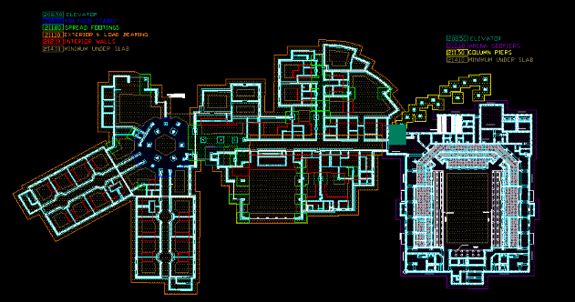
Footing Excavation Plan.
Each color indicates a specific
elevation for the footings.
Each color indicates a specific
elevation for the footings.
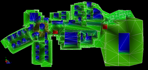
3D surface model created
using the footing excavation
plan.
using the footing excavation
plan.
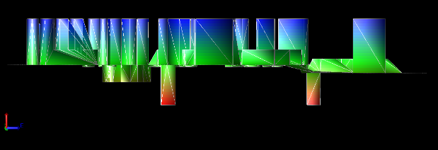
Surface model, elevation view
at an exaggerated scale.
at an exaggerated scale.
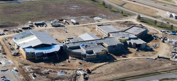
Photo of actual construction.
| Copyright © 2009 all rights reserved Digital Design Consultants |