Carlos Wood, P.E.
Engineering Consultant
Engineering Consultant
GIS (Geographic Information System):
Utilizing GIS capabilities to capture, store, analyze and display geographically referenced information.
Creating maps with layers of data about particular features for reference and study.
Using GIS to serve our clients for many different types of projects including property maps, land use
& zoning maps, street maps, floodplain area delineation maps, and municipality infrastructure
planning and utility mapping.
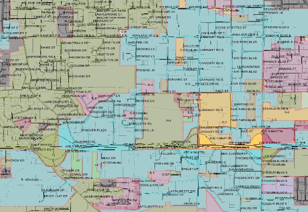
Land Use Zoning Map
with Street Names.
Each zone is
represented with an
unique color.
with Street Names.
Each zone is
represented with an
unique color.
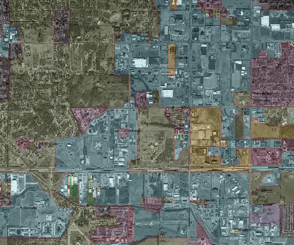
Land Use Zoning Map
with Aerial Photography
Each zone is
represented with an
unique color.
with Aerial Photography
Each zone is
represented with an
unique color.

Land Parcel Map with
street casings & street
centerlines.
street casings & street
centerlines.
| Copyright © 2009 all rights reserved Digital Design Consultants |